 |
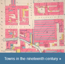
| Bray and Belfast (Part II, 1840 to 1900) are the towns explored in today's last-in-the-series digital release. |
Bray and Belfast (Part II, 1840 to 1900) are the towns explored in this digital release.
Each of the digital editions is published with the relevant chapter from Reading the maps: a guide to the Irish Historic Towns Atlas* and includes the full text of the printed edition (essay, topographical information, bibliography, appendices, notes for each town) as well as a selection of maps.
The Irish Historic Towns Atlas (IHTA) is a research project of the Royal Irish Academy that aims to record the topographical development of a selection of Irish towns both large and small. It has been publishing maps and publications about Ireland's towns and cities since 1986, and is part of a wider European project that explores historical towns according to a fairly rigid formula of detailed enquiry and presentation. The 'formula' allows comparisons across the continent.
The resulting publications examine the topographical development of each town during key periods in their history.
Clues to the town's past religious life, defence and security, local and national government, industry, trade, transport, education and leisure habits are explored within the accompanying maps. Dense and accurate, these atlases reveal fascinating details about the physical environment and communities our ancestors lived in.
You can see the line-up of 25+ digital IHTA editions here.
* By Jacinta Prunty and H.B. Clarke (Dublin, Royal Irish Academy, 2011)
